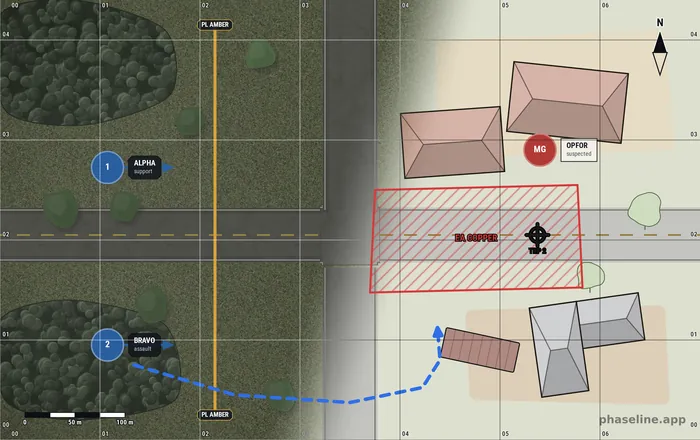
The Editor
Click “Launch Tool” to open the Phaseline editor right here on this page. Everything runs locally in your browser – your maps stay with you.
▶ Launch Tool↗ Open in a new tabThe editor needs a wide screen and a mouse. On a phone, read the blog first — the maps in the articles open in the editor when you are back at a desktop. Read the blog
What You Can Build
Phaseline is a sand table in a browser tab. You build the ground, you draw the plan on it, and you leave with a map sheet that your team can read.
Build the ground
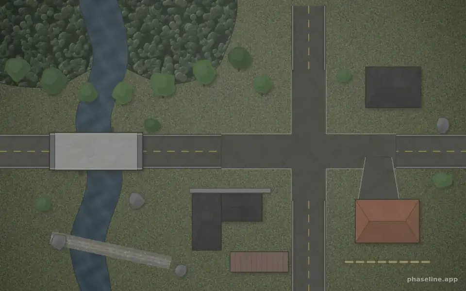
Terrain and infrastructure
Roads, dirt roads, trails, T- and X-junctions and driveways. Houses, walls, fences, containers, bunkers and bridges. Water with a shore line, and free-shaped terrain areas in eight textures. One stroke of the scatter brush fills a wood line with trees, bushes and rocks.
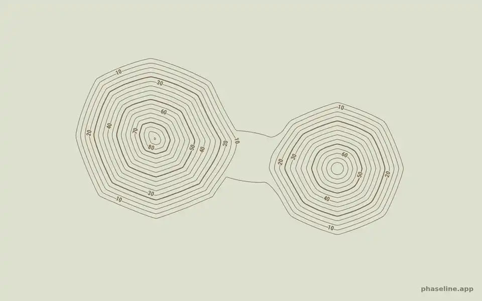
Relief you sculpt like sand
Pile, dig and flatten the ground with a brush. The height grid obeys an angle of repose, like real sand: more material makes a hill wider, never steeper, and two piles find their own saddle. Field mode shades the relief. Doctrine mode prints contour lines with their heights.
Your own map underneath
Load an aerial photo, a screenshot of a game map, or an image address. Position it and zoom it inside the export frame, then draw the situation on top of it. The image stays in your browser.
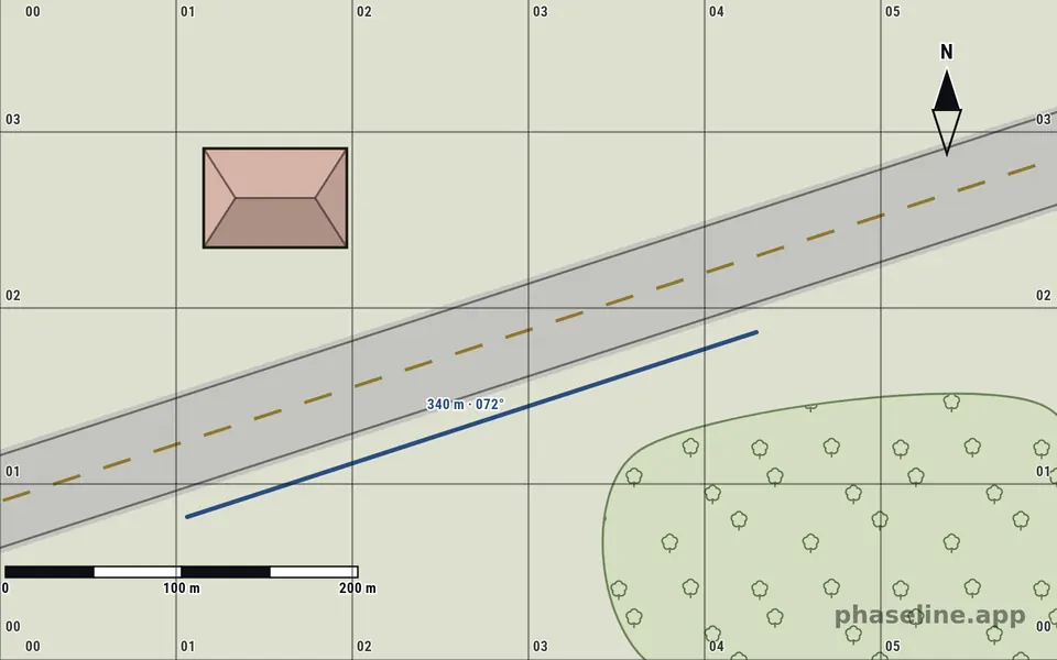
Real scale, grid references and measure
Set the width of the map in meters, and the scale bar adjusts itself. Add a grid with easting and northing numbers, so your team can call a square. The ruler measures true distances, and every open line prints its own length and its bearing in three digits.
Draw the plan
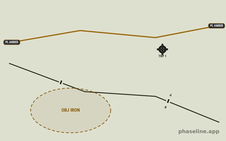
Control measures, by doctrine
Phase lines, boundaries with an echelon amplifier from squad to army, objectives, engagement areas, axes of advance, target reference points and checkpoints. Line patterns for an obstacle line, a fortified line and the FLOT. These are map graphics, not generic shapes.
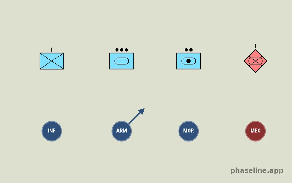
A circle, or an APP-6 symbol
A unit marker is a coloured circle with an abbreviation, a label that docks to it and a direction arrow. When you need the standard instead, place an APP-6 / MIL-STD-2525 symbol: the scene keeps its SIDC, and the Icon Lab lets you compose symbols and keep a library of them.
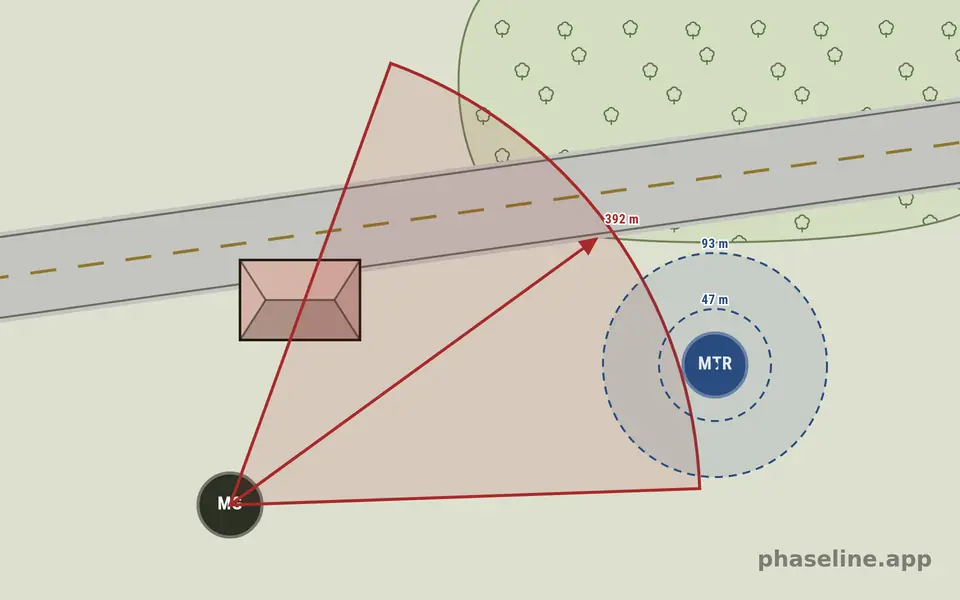
Sectors, ranges and fields of fire
A sector fan takes a left limit, a right limit and a range. Range rings print their distances. Both can fill the area they cover, so a reader sees the ground under the lines and not only the lines.
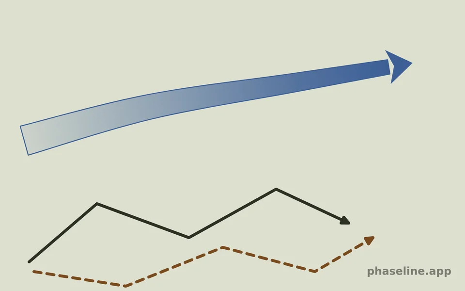
Movement and maneuver
Plot routes as solid, dashed or dotted lines with arrow heads. Draw a broad axis of advance that tapers to its tip. Bounding overwatch, a flanking maneuver, the crossing of a linear danger area — each one is a line you can still move, point by point.
Deliver the brief
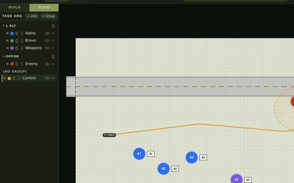
Task Org, not a layer list
Group your layers into units — 1 PLT, OPFOR, Control — and give each unit a colour. A new object takes the colour of the active unit. One click hides a whole group during the brief, and the object list groups by unit or by category.
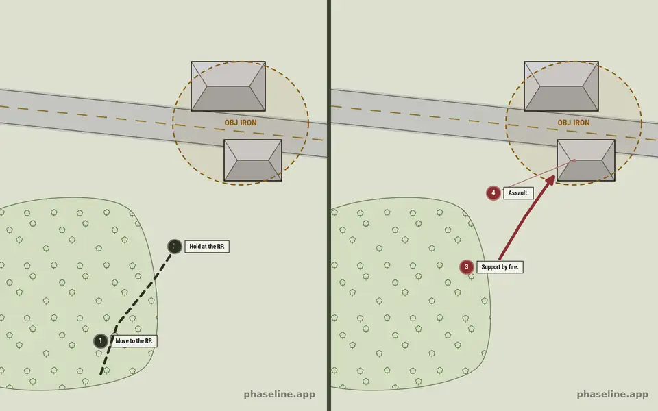
Phases and steps
Split the operation into named phases: infiltration, assault, consolidation. Assign each element to one phase or to several, filter the map live, and show the previous phase as a ghost. Numbered step chips put their sentence in the margin, where it does not cover the map.
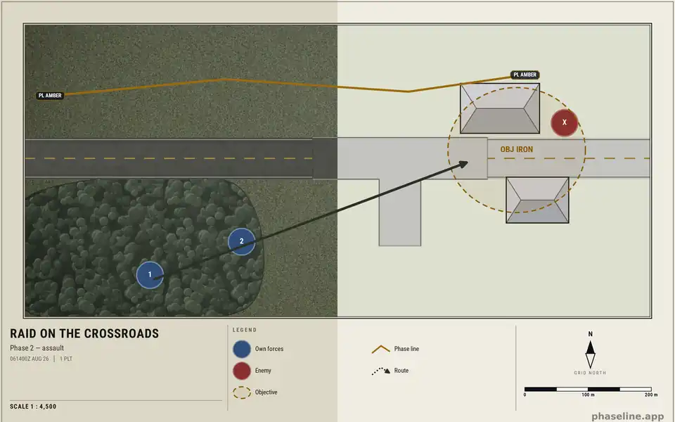
Field or doctrine, and a real sheet
The same scene has two looks. Field keeps the ground texture, for an after-action map. Doctrine puts the plan on paper: flat light ground, no texture, maximum contrast. Switch the sheet on and the map gets a neatline, a title block and a legend that the app derives from the symbols you used.
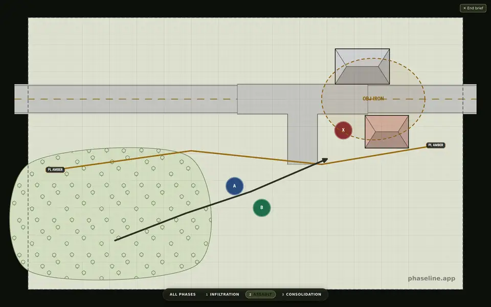
Export, and brief
Export the sheet as a PNG at 1×, 2× or 3× — up to 12000 px on a side — or one numbered PNG for each phase. Brief mode then hides the editor and steps through the phases on the full screen. Nothing is uploaded: a scene is a file on your disk.
Who Is Phaseline For?
A sand table is not only for a game. It is for any group that must agree on the ground and on the sequence before it starts.
Commanders and mission planners
You must show a whole operation on one sheet: the phases, the boundaries between your units, the engagement areas, the axes. Phaseline draws control measures at the echelon you work at, from a squad boundary to a corps boundary, and the Task Org follows the same order as your OPORD.
Team and squad leaders
Your level is the action on the objective. Build the small terrain model for your order and your rehearsal: the wood line, the ditch, the gun, the assault line. Then walk your team through it, one numbered step at a time.
Instructors and course writers
Battle drills, tactical decision games, sand table exercises and TEWTs. One scene becomes a handout, a slide series and an editable file that your students open themselves — and doctrine mode prints in the register that they already read.
Airsoft and milsim organizers
A field overview that a new player understands on the first look: safe zones, respawns, objectives and the boundary of play. Load an aerial photo of your site and draw straight on top of it.
Game masters and mission makers
ARMA 3 and Reforger, Squad, Hell Let Loose. Screenshot the game map, put it underneath, and hand your players a briefing image instead of a wall of text. Every map opens again in the editor, so the next mission starts from the last one.
Writers, wargamers and historians
Redraw a historical engagement, illustrate a rule set, or make the diagrams for your article or your video. The export carries one small credit line and nothing else. There is no watermark, no account and no export limit.
How It Works
Build the Terrain
Drag road segments, crossroads and buildings from the palette onto the canvas – grid snapping keeps every piece perfectly aligned.
Draw the Situation
Place unit markers, align sector arrows, plot movement paths and add labels.
Export & Brief
Export as PNG and share it with your squad. Scenes can be saved and edited later for the next phase.
Latest from the blog
Doctrine, control measures and exercise design — with maps you can open and keep building in the editor.
Commander's Intent
What it is, what goes into it, and how to phrase it so it survives the plan
August 5, 2026React to Contact, in Six Frames
The battle drill that every other one starts from — six frames, and only one of them contains a decision
August 2, 2026Tactical Decision Games
Train the decision, not the plan
Frequently Asked Questions
Which games is Phaseline suited for?
Any tactical scenario: ARMA 3 and ARMA Reforger, Squad, Hell Let Loose and comparable milsim titles – as well as real-world airsoft games where game masters or squad leaders want to prepare a briefing with a tactical map.
What can I place on the map?
Terrain, roads, buildings, water and bridges, and relief that you sculpt with a brush. Unit markers, or APP-6 symbols from their SIDC. Phase lines, boundaries, objectives, engagement areas, axes of advance, TRPs and checkpoints. Routes, sector fans, range rings, labels and a title block.
How do I export my tactical overview?
With one click as a high-resolution PNG. You can drop the image straight into Discord, your unit's forum or your briefing slides.
Is Phaseline free?
Yes. Phaseline runs directly in your browser – no registration, no installation.
Is Phaseline only for games?
No. Phaseline is a sand table, and a sand table has no genre. It is used to prepare a briefing, to run a tactical decision game, to teach a battle drill, to plan an airsoft field, and to redraw a historical engagement for an article. The editor knows nothing about any particular game.