Dieser Eintrag ist nicht übersetzt. Du liest den englischen Text. Zum englischen Original
What it does
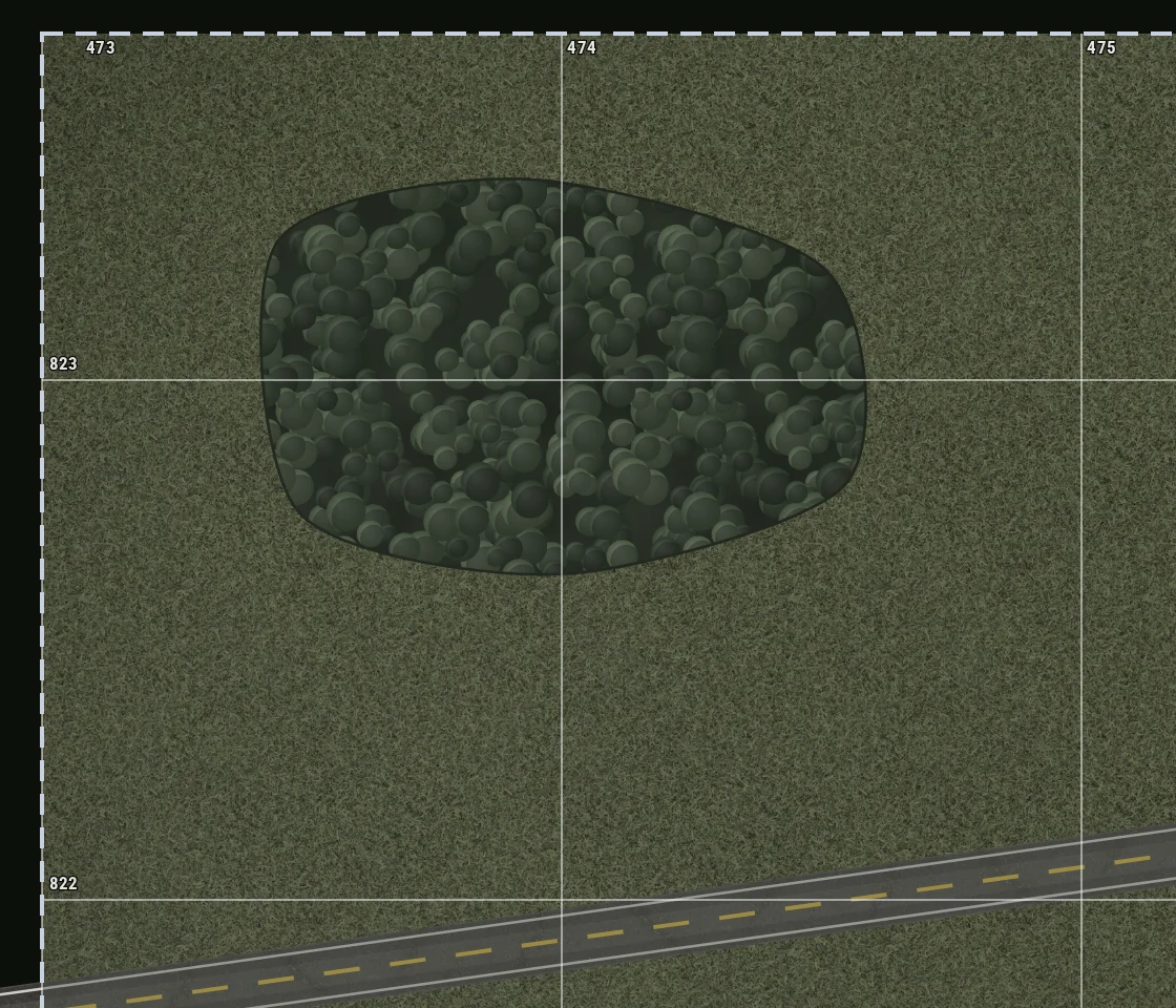
The map grid writes a number on each of its lines. Two of those numbers name one square: first the number on the vertical line at its west side, then the number on the horizontal line at its south side. That pair is a grid reference. It gives a place on the map in a form that you can say on the radio and that everybody with the same map finds.
Why it is there
"Behind the second wood" is not a position. It is correct only for the person who says it, and only from the place where that person stands. A grid reference is the same for everybody who has the map, from each direction, at night and on a bad radio. It is also shorter than any description of the ground.
How to use it
- Find the vertical line to the west of your point. Read its number. This is the easting.
- Find the horizontal line to the south of your point. Read its number. This is the northing.
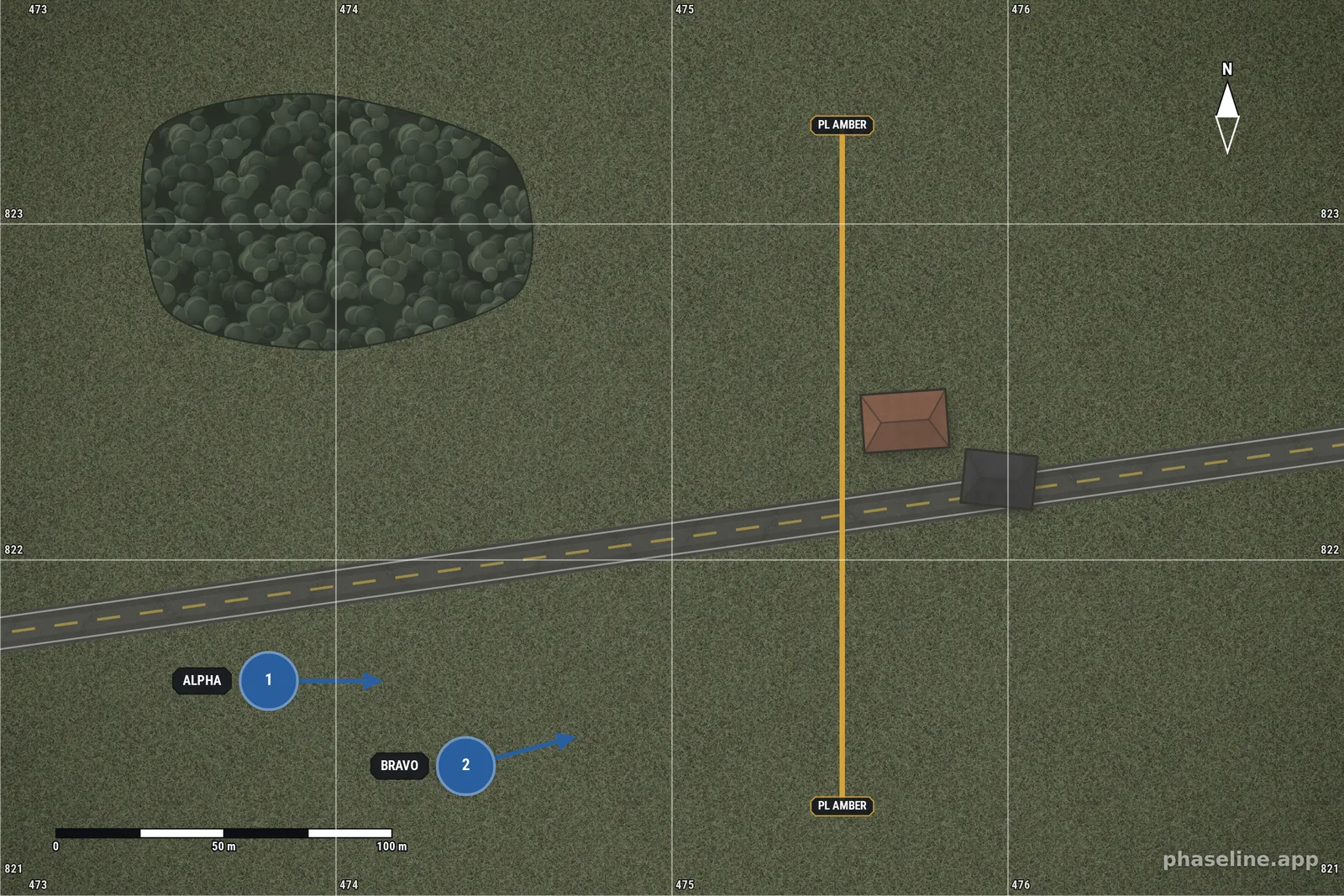
- Say the easting first and the northing second. The old rule for this is "read right, then up". The farm on the example map is in square 475 822.
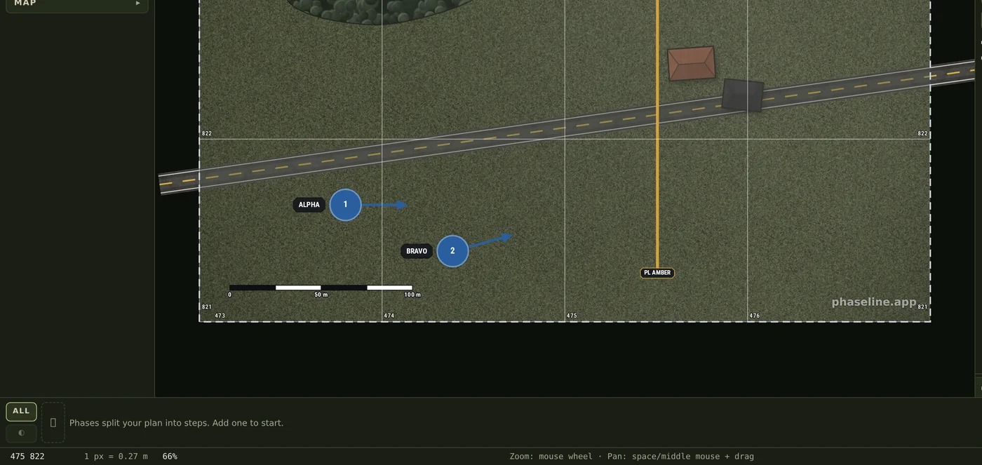
- Move the pointer over the map. The status bar in the bottom left corner shows the reference of the square below the pointer.
- Set the size of the square in Grid interval, in the Canvas & scale block. A 1 km square gives four figures, a 100 m square gives six, and a 10 m square gives eight.
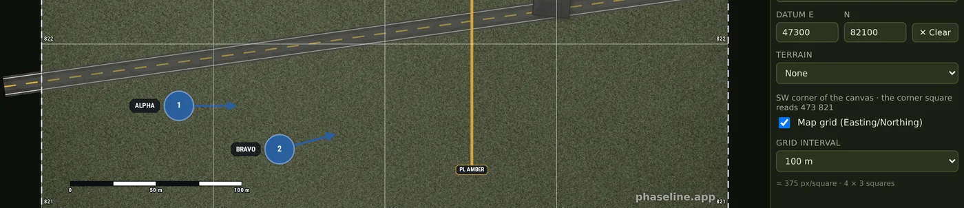
- To get the numbers of real ground, write the coordinate of the south-west corner of the canvas into the two Datum fields, in the Canvas & scale block. The grid then shows the coordinates of that ground. Set Map width (m) first, because a datum is metres.
- If the map is a part of a map sheet, use ✂ Cut area… in the Ground block. The cut writes the Datum together with the picture, the canvas size and the map width.
On the map
The example is the map of the Scale and grid entry with a datum on it. The two maps are the same ground and the same grid, but this one knows where that ground is: its south-west corner is 47 300 m east and 82 100 m north of the origin of the terrain. Thus the lines carry 473 to 476 and 821 to 823 instead of 00 to 03 and 00 to 02.
Limits
- A grid reference names a square, not a point. Six figures name a square of 100 m, and something inside that square can be 140 m from something else in it.
- With no Datum the numbers are indices of this picture. They start at 00 in the south-west corner, and they change when the size of the canvas changes.
- Two controls write a datum: the Datum fields in the Canvas & scale block, and the ✂ Cut area… dialog. The ✕ Clear button removes it.
- A datum needs a map width. The Datum fields do not accept a number while Map width (m) is empty, and a datum goes away when you remove the map width.
- The numbers repeat after 100 km, as on a military map. The grid does not show the letters of the 100 km square.
- A datum that is wrong is worse than no datum, because the references then look correct and name different ground. Clear it when you move the scene to other ground.
Related
- Scale and grid — the map width and the interval that this grid comes from.
- Control measures, explained in pictures — the lines that you give a reference to.
- Graphic control measures — how a reference goes into an order.
- All the entries of this handbook — one page for each function of the editor.